Ancient Map of the World of Forbidden
Enjoy a map of the ancient Mesopotamian and Middle East. See if you can identify the modern-day countries by comparing to a modern map. Please feel free to use this map in History, Social Studies, English, or Writing Classes with your students or Book Clubs. My Teacher’s Guides and Book Club Guides – with fabulous Discussion Questions as well as super fun activities – are right here on each book’s individual page as a free PDF. Copy and pass out!
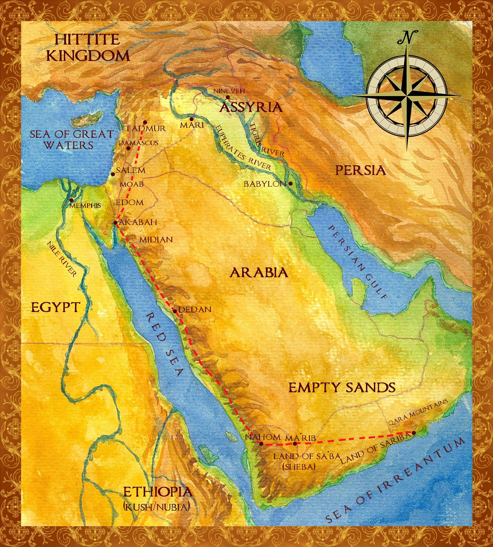
The red dotted line on the map is the Ancient Frankincense Trail from the oasis at Tadmur (modern-day Palmyra, Syria), down through the huge trading center of Ancient Edom or known as the Nabatean Kingdom in the 2nd century B.C.E (Petra, Jordan), until the caravans reached the Frankincense Lands (modern-day Salalah, Oman). The Frankincense Trail was used between 1700 B.C.E. and approximately 200 C.E. At this point in history the isolated region where frankincense grew naturally was lost to the known world for centuries until the late 1890’s C.E.
If you have any questions, please email me at kglittle@msn.com.
View the Full Sized Map Here


Follow Kimberley: